
The big change in this release is the addition of GPS coordinates to named locations.
Named Locations
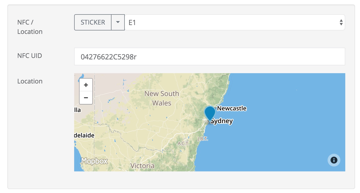
When you add or edit a task you can set the GPS coordinates, an NFC identifier or both to specify where the task should take place. This is what we call an anonymous location since you are not using a “Named Location”.
However you can now also enter the name of a “location” that has the NFC UID and/or the GPS coordinates pre-defined. To do this Select the group name first and then the location name. (This change addresses issue #468).
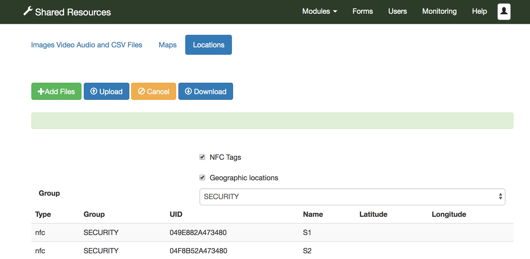
Named locations are shown in the “Shared Resources” page. Select the Admin module then “Shared Resources” , then select the “Locations” tab to view them. Click on the “Download” button to get the current locations in an excel file, or an empty template if you have not specified any locations.
Loading Named Locations from an Excel file
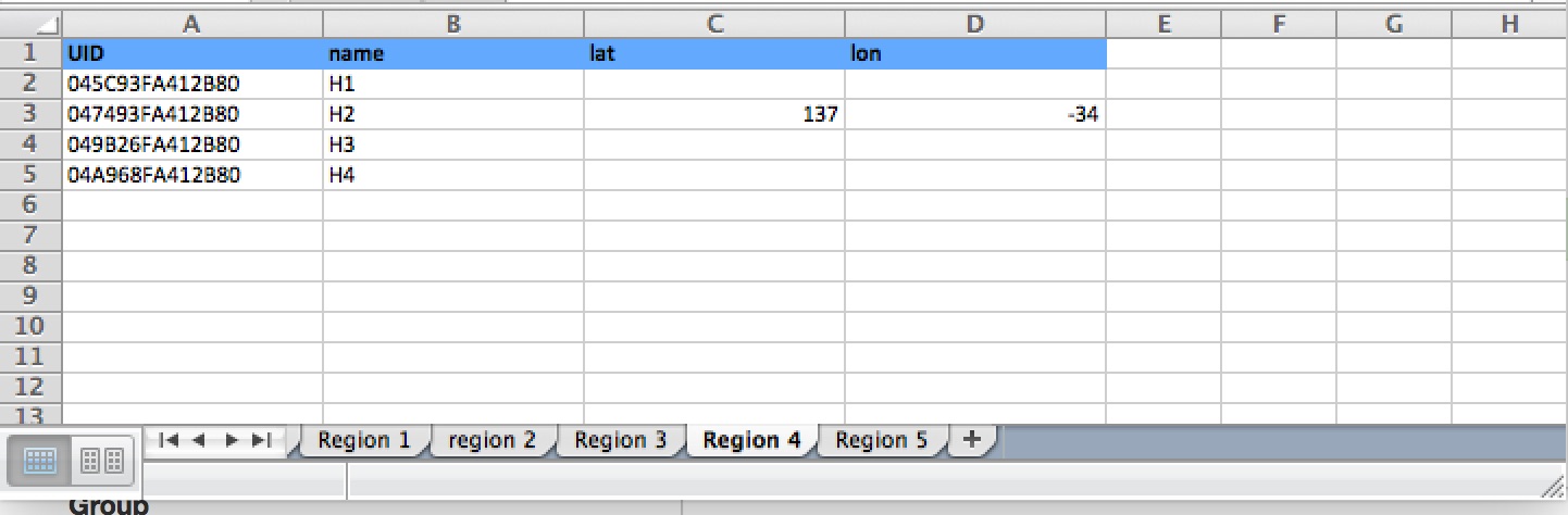
Locations are organised into groups and each group is shown in a separate tab of the excel file. Create new tabs giving each one a unique group name. Then for each group create locations. You can specify:
- UID: The identifier of an NFC chip at the location
- name: The name of the location
- lat: The latitude in GPS coordinates
- lon: The longitude
The location name must be unique within the group. When the file is ready select “Add Files” and then “Upload”.
Updating a location when editing a task
After selecting a location you may adjust the GPS coordinates or change the NFC UID. You then have the option of:
- Continuing with an anonymous location
- Updating the location with the new coordinates / NFC UIC
- Saving a new named location
Other changes
- Added “auto” as a parameter option in the online editor to automatically start camera, barcodes and NFC reader when the user swipes to that question. The auto start is only applied when swiping forwards, there is not already a value recorded for the question and the question is the first one on the page. (This update implements issue #475)
- Drastically reduced the memory required when importing data from an excel spreadsheet. This was tested importing 80,000 rows each with 500 columns without any problem. This new version is also much faster than the previous import.
- API changes
- In PDFs allow the colour of a marker showing position to be configured using an appearance setting for the geopoint question
- Fixed issue #433. The advanced filter was not working correctly with wildcards.